Chapter 1
Gis maps contain layers: layers are collections of geologic data that are alike and defined by a symbol. These layers are then piled on top of each other in GIS software
Layers contain features and surfaces
A Feature is a geographic object such as a lake transmission line or coal basin
These features then have Size and Shape which can be represented by points lines or polygons and collectively these things are called “vector data”
A Surface is normally a natural phenomena that has no distinct size or shape such as elevation, slope, temperature and rainfall. Instead of a specific shape they have measurable values for any location on Earth’s surface. the most common kind of surface is a “raster”, which is a matrix of identically sized squares
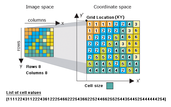
Features have locations
Features can be displayed at different sizes: by this is it meant that you can viewed at different scales which can be changed by zooming out and in to a map, normally when this is done different layers containing different types of detail can be seen, the amount of detail does not change just whether you can see them or not.
Features are linked to information: each feature has specific information about the feature linked to it about anything known about the feature. In the case of countries this may contain things such as population, capital, system of government and average rainfall
Features have spacial relationships: Things are near things, and those things sometimes touch each other or overlap each other and sometimes are even within one another
New features can be created from areas of overlap: sometimes when features overlap they create a new set of conditions that can be defined separately from the two parent features while still being part of both
Chapter 2
ArcGIS has several different applications and tools contained within the software.
Applications: ArcMap and ArcCatalog which are used most frequently, then ArcScene and ArcGlobe which are used for 3D visualizations
the geo processing tools are available through the ArcToolbox and Modelbuilder application which are accessible from both ArcMap and ArcCatalog
GIS tasks normally fall under two categories: mapmaking, editing, spatial analysis; and Database design and data management which are completed using ArcMap and ArcCatalog.
ArcScene is used for viewing GIS in 3 dimensions. while ArcGlobe is based on a 3d global model of GIS data
Esri data, which is simply Gis data that can be accessed online i believe


